🦏 Rhino Hill Peak Trek — The Aberdares Range | Northern Aberdare Moorland Trail
Safari at a Glance
Wild Springs Adventures | 📍 Kwa Matu, Nyandarua County
🌾 The Peak That Almost Nobody Knows About
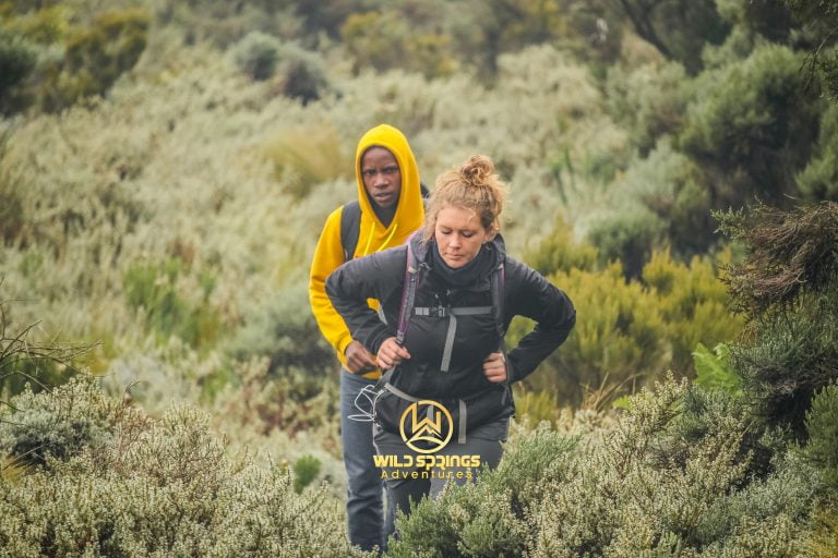
Every serious hiker in Nairobi can list the Aberdare peaks. Elephant Hill. Rurimeria. Table Mountain. Seven Ponds. Kinangop. Satima. Those are the trails that appear in every hiking group, every tour operator brochure, every social media post. They are well-known, well-trodden, and well-documented.
Then there is Rhino Hill.
At 3,890 metres above sea level, Rhino Hill sits in the golden heart of the northern Aberdare moorland — higher than Rurimeria (3,860m), higher than Table Mountain (3,817m), higher than Seven Ponds (3,826m). It is the hidden fifth-highest accessible point on the Aberdares. The peak was named by local guides who work these moorlands daily — not by a colonial cartographer or a formal survey. It appears on no official map. It has no dedicated trailhead signboard. The route to it goes off the established Seven Ponds trail into open moorland, following lines that only those who know the range can read.
The approach from Kwa Matu covers approximately 17km round trip, gains 1,230 metres of elevation, and takes between 7 and 10 hours. The trail crosses the full character of the northern Aberdare plateau — water bogs that test your gaiters, vantage rocks that reward patience with panoramas, and a final moorland push to a summit where Rurimeria, Satima, Table Mountain, Kipipiri, and, on clear days, Mount Kenya are all simultaneously visible.
The name itself carries a story deeper than most hikers expect. The black rhinoceros was once abundant across the Aberdare forests. By the 1980s, relentless poaching had reduced the population to critical levels — estimates suggest fewer than 50 animals remained in the range by 1987, down from 450 in the 1970s. The Aberdare Salient was designated as a formal black rhino sanctuary in 1988. Then in 2010, Rhino Ark completed the world's longest conservation electric fence — 400km encircling the entire Aberdare ecosystem. Every hiker who crosses the KWS electric fence at the trailhead passes through the perimeter of that sanctuary. Rhino Hill, named by the guides who watch these ranges daily, carries that conservation history in its name.
🎯 The honest truth:
This is not a trail for hikers who need signboards and worn paths. Beyond the Seven Ponds section, the route to Rhino Hill is off the beaten path in the truest sense — unmarked moorland, water bogs, and route-finding by local knowledge. The views are exceptional. The solitude is complete. The difficulty is real. Come with a guide who knows exactly where Rhino Hill is. Come with gaiters. Come with the right expectation. You will not regret it.
📋 Rhino Hill Peak Trek at a Glance
| 🦏 Summit | Rhino Hill, ~3,890m (12,762ft) |
| 📈 Elevation Gain | ~1,230m from Kwa Matu gate |
| 📏 Distance | ~17km round trip |
| ⏱️ Time on Trail | 7–10 hours |
| 📍 Trailhead | KWS Electric Fence gate, Kwa Matu, Nyandarua County |
| 🗓️ Trailhead Altitude | ~2,628m (8,622ft) |
| 💪 Difficulty | Hard — off-trail moorland navigation, high altitude, boggy terrain |
| 🗺️ Trail Type | Off established path beyond Seven Ponds — guide knowledge essential |
| 🛣️ Distance from Nairobi | ~155km (approx. 2.5–3 hrs drive) |
| 🪖 Guide Requirement | Armed KWS ranger + certified guide — mandatory and non-negotiable |
| 🐾 Trail Status | One of the least-visited summits in the Aberdares |
| 🦏 Conservation Context | Named within the Aberdare Black Rhino Sanctuary, enclosed by the world's longest conservation fence |
🦏 The Name and Its Weight — Black Rhino in the Aberdares
A mountain's name tells you something about the people who named it. Elephant Hill was named for its shape and its elephants. Table Mountain for its flat summit plateau. Dragon's Teeth for the basalt formations spiking out of the northern moorland. Rhino Hill was named by the local guides who work this section of the Aberdare moorland — the men who cross these bogs and vantage rocks in all seasons.
The black rhinoceros (Diceros bicornis) — specifically the Eastern Black Rhinoceros (Diceros bicornis michaeli) — once roamed the Aberdare forests in their hundreds. By the late 1970s, an estimated 450 black rhinos lived in the range. The 1980s changed everything. Poaching for horn, combined with habitat destruction, saw the population collapse to an estimated 50 animals by 1987. A population that had taken centuries to build was nearly destroyed in less than a decade.
In 1988, Rhino Ark was established with a single focus: to save the dwindling black rhino of the Aberdares. The Aberdare Salient was fenced and designated a formal rhino sanctuary that same year. Over the following two decades, the fence expanded until, in 2010, the President of Kenya commissioned the completed project: a 400km electric conservation fence encircling the entire Aberdare ecosystem — the longest conservation fence in the world. This is what every hiker passes through at the trailhead. It is what has given the black rhino population a chance to recover.
Today, the Aberdare holds the second-largest black rhino population in Kenya — a conservation recovery that has taken decades of sustained effort. Rhino Hill stands in the northern moorland of that sanctuary. Its name is not incidental. The guides who walk this ground every day named it after the animal that the fence was built to protect.
🕐 The Full Day 🦏 Rhino Hill Peak Trek itinerary— Hour by Hour
🚐 04:30 – 05:00 · Nairobi · Departure
The drive to Kwa Matu takes about 2.5 to 3 hours via the Nakuru highway and north through the Kinangop Plateau. The approach shares the same road as Seven Ponds and Table Mountain. You arrive as the day begins. The plateau is cool, often misty. Nobody else is heading to the same destination.
📋 07:30 – 08:00 · KWS Electric Fence Gate, Kwa Matu, ~2,628m · Briefing & Start
Park fees paid. Armed KWS ranger collected. Your guide explains the route — the trail starts identically to Seven Ponds, but it will diverge later into unmarked moorland. The key rule before you step through the fence: if the weather closes in above 3,500m, the guide's decision to turn back is final. You nod, lace your boots, and cross through the fence.
⛰️ 08:00 – 10:00 · 2,628m – 3,100m · The Opening Climb
The first section shares its route with Seven Ponds. The trail begins with 2km of steep, twisting ascent — no gentle warm-up. Through dense vegetation, gaining altitude hard and fast. At roughly 1.5km, the viewpoint opens: the Kinangop Plateau below, Mt Kipipiri visible to the west. The worst climbing of the day is behind you. Breathe. Keep moving.
🌿 10:00 – 11:30 · 3,100m – 3,400m · Rocky Outcrops & First Moorland Views
The vegetation shifts to more open indigenous trees. Rocky outcrops provide rest points. Views of Rurimeria to the northeast and Table Mountain to the northwest appear simultaneously. Altitude effects begin above 3,000m. Slow your pace. This is not where you expend your reserves.
🌾 11:30 – 12:30 · 3,400m – 3,826m · The Seven Ponds Plateau — And the Divergence.
The trail enters the northern Aberdare moorland. Golden tussock grass in every direction. Giant Lobelia at the trail's edge. The full Aberdare ridge is visible simultaneously — Satima to the north, Table Mountain northwest, Rurimeria northeast. The Seven Ponds tarns glint in the morning light. Most groups stop here, eat lunch, and turn back.
Your group does not stop. Beyond the ponds, the guide takes you off the established path and into the open moorland heading northeast. This is where Rhino Hill begins.
⚠️ Navigation note: Beyond Seven Ponds there is no marked trail. Navigation depends entirely on your guide's knowledge of this specific section. Any group attempting Rhino Hill without a guide who knows this section will not find the summit.
🦏 12:30 – 14:30 · 3,826m – 3,890m · The Off-Trail Moorland Push
The open moorland between Seven Ponds and Rhino Hill is the defining section of this trail. Water bogs — waterlogged sections of the plateau — cross the route at irregular intervals. Your gaiters are working. Your trekking poles test ground before you commit your weight. The grass stands waist-high in places, hiding the drainage channels. The guide reads the ground ahead, choosing lines that keep you out of the deepest bogs.
Vantage rocks — volcanic outcrops scattered across the moorland — rise from the tussock at intervals. From each one, the view extends further: Seven Ponds behind you, Table Mountain to the northwest, Rurimeria to the east, Satima to the north. You are in the middle of all of it.
Then Rhino Hill comes into focus ahead — a prominent moorland rise, distinctive in shape from the surrounding plateau. The summit profile, seen from below across the tussock, has the distinctive hunched bulk of a black rhino at rest. The final push to the top is steep but short.
🏆 14:30 · 3,890m · THE SUMMIT — The View Nobody Talks About
This is the view that almost nobody in Kenya has seen from this exact point. Standing at 3,890m on a summit with no official name on any map, visited by fewer hikers per year than almost any other named point on the Aberdares:
- North: Satima's summit, Kenya's third-highest mountain
- Northeast: Rurimeria's moorland plateau and the Seven Ponds tarns
- East: The full northern Aberdare escarpment
- South: Table Mountain's flat-topped profile, Lake Ol Bolosat beyond on clear days
- West: Mt Kipipiri alone in the Wanjohi Valley, the Rift Valley beginning beyond
- On exceptional days: Mount Kenya to the northeast, glaciers above the clouds
There is no one else here. No sign. No cairn marked by previous visitors. Just the wind, the tussock, the bogs behind you, and one of the finest views in the northern Aberdares.
15:00 — descent begins. Afternoon fog on the open moorland is the consistent danger.
⬇️ 15:00 – 17:30 · 3,890m → 2,628m · The Return
Back through the open moorland, picking through the water bogs in reverse. Vantage rocks guide the return. Back to Seven Ponds for a final look. Then down through the rocky section and the steep descent. Poles essential. Slippery after any rain.
🚐 Leave the Gate by 17:00. Nairobi by 20:00. Tomorrow, you will tell people about a peak they have never heard of.
🗺️ The Four Trail Sections of Rhino Hill Aberdares Hike
⛰️ Section 1 · 2,628m – 3,100m · The Steep Opening
Shared with Seven Ponds. 2km of relentless steep ascent. The viewpoint at 1.5km is the first reward. This is where the day declares itself.
🌿 Section 2 · 3,100m – 3,400m · Rocky Outcrops & Moorland Views
Indigenous montane trees, volcanic rest points, and simultaneous views of Rurimeria and Table Mountain. Altitude effects begin. Pace is everything.
🌾 Section 3 · 3,400m – 3,826m · Seven Ponds Plateau
The most photographed section of northern Aberdare moorland. Golden tussock, Giant Lobelia, glacial tarns. Most groups stop here. You keep going.
🦏 Section 4 · 3,826m – 3,890m · Off-Trail Moorland to Rhino Hill
No marked trail. Water bogs. Vantage rocks. Open moorland navigation by guide knowledge. The summit rise distinctive in shape. The view from the top, earned completely.
🌸 Flora Along the Trail Rhino Hill Trail
The Rhino Hill trail traverses the same ecological zones as Seven Ponds for its first three-quarters — then enters an even less-disturbed section of the northern Aberdare moorland for its final push.
In the lower sections, the indigenous montane forest holds African pencil cedar (Juniperus procera) and East African camphor (Ocotea usambarensis) in the upper canopy. Wild ginger and thick mosses carpet the wetter drainage channels — part of the 778 recorded plant species of the Aberdare Range.
As the trail opens onto the moorland, Giant Heather (Erica arborea) marks the transition. The tussock moorland follows in rolling golden waves of Deschampsia grass, broken by Giant Lobelia (Lobelia deckenii) — the towering spike-leaved sentinel of the Afro-alpine zone — with the Scarlet-tufted Malachite Sunbird feeding at its flowers.
On the off-trail section beyond Seven Ponds, the concentration of Dendrosenecio battiscombei — the ancient giant groundsel of East Africa's high mountains — increases noticeably. These plants grow here undisturbed in a way they cannot on the more visited trails, their silver-green crowns standing two to four metres above the tussock. Helichrysum gloria-dei — the Aberdare-endemic everlasting flower — covers open faces in gold and cream. Lady's Mantle (Alchemilla spp.) fills the boggy drainage channels with its characteristic dew-collecting leaves. This off-trail moorland section is, botanically, one of the most undisturbed stretches of Afro-alpine vegetation accessible on a day hike from Nairobi.
🦁 Wildlife & Nature - Rhino Hill Aberdares Hike
Rhino Hill sits within Aberdare National Park — a designated Important Bird Area (IBA) and the second-largest black rhino sanctuary in Kenya.
| 🐾 Species | 👁️ Likelihood | 📍 Where | 📝 Note |
|---|---|---|---|
| 🦏 Black Rhinoceros | ★★☆☆☆ | Northern moorland | The Aberdare holds Kenya's second-largest black rhino population. Moorland sightings are rare but confirmed. The armed ranger is mandatory for this reason. |
| 🦌 Mountain Reedbuck | ★★★★☆ | Open tussock moorland | Common on the plateau and near Rhino Hill summit — frequently seen grazing on open ground above 3,500m |
| 🦌 Eland | ★★★☆☆ | Open moorland near summit | Africa's largest antelope moves through the northern plateau in small groups |
| 🐘 Forest Elephant | ★★★☆☆ | Lower forest & moorland edges | Footprints and droppings regular on the lower section; armed ranger leads through these areas |
| 🦬 Buffalo | ★★★☆☆ | Forest-moorland transition | Common sign; occasional live encounters near the moorland entry |
| 🦁 Serval Cat | ★★☆☆☆ | Open tussock moorland | Prime serval habitat — the northern plateau is one of their best habitats in Kenya |
| 🐆 Leopard | ★★☆☆☆ | Rocky outcrops & forest edges | Confirmed presence; sightings rare and memorable |
| 🐦 290+ Bird Species | ★★★★★ | All zones | See birding section below |
🔭 Birding at Rhino Hill — The Undiscovered Hotspot
Rhino Hill's off-trail section sits in some of the most undisturbed Afro-alpine moorland in the Aberdares. Very few birders have ever submitted eBird checklists from this specific plateau section — making any visit a genuine contribution to citizen science data.
- Aberdare Cisticola (Cisticola aberdare) — Kenya's only true highland endemic. The undisturbed tussock moorland between Seven Ponds and Rhino Hill is among the least-recorded but most habitat-appropriate areas for this species in the range.
- Moorland Chat (Pinarochroa sordida) — conspicuous on the vantage rocks throughout the off-trail section, perching on exposed stones above the tussock.
- Scarlet-tufted Malachite Sunbird (Nectarinia johnstoni) — follows the Giant Lobelia flowering cycle across the plateau.
- Jackson's Francolin (Pternistis jacksoni) — near-endemic, regularly encountered in the lower vegetation transition zones.
- Mountain Buzzard — circles above the open moorland on morning thermals.
- African Stonechat — present on exposed rocks from the viewpoint through to the Rhino Hill summit.
Log your sightings at the Aberdare National Park eBird hotspot. Rhino Hill sightings contribute to an extremely thin data record for this section of the northern plateau — every checklist is genuinely useful.
💰 Rhino Hill Aberdares Pricing — 2026
No hidden charges at the gate. Everything below is complete.
| 🇰🇪 Kenyan Citizens | 🌍 East African Residents | 🌐 International |
|---|---|---|
| KES 4,999 per person | KES 5,700 per person | USD 99 per person |
Group discounts for 5+ people. Contact us for a private group quote.
✅ What's Included
- 🚐 Round-trip transport from Nairobi (CBD/Westlands pickup)
- 🏞️ Aberdare National Park entry fees
- 🪖 Mandatory armed KWS ranger for the full day
- 🧭 Certified Wild Springs guide — Rhino Hill experienced
- 🍱 Packed lunch and trail snacks
- 💧 Drinking water
- 🩺 Emergency first aid kit and evacuation support
❌ Not Included
- 👟 Personal hiking gear: waterproof boots, gaiters, gloves, warm layers
- 🙏 Guide & ranger tips (KES 1,000–2,000 suggested)
- 🛡️ Travel insurance (strongly recommended)
- ➕ Optional traverses to Table Mountain or Rurimeria (see below)
➕ Traverse Extensions — Get More from the Northern Moorland
💧 Rhino Hill + Seven Ponds — Included in standard package.
The standard booking covers the Seven Ponds approach and the Rhino Hill summit. The Seven Ponds tarns are visited on the way to and from Rhino Hill.
🗻 Seven Ponds + Rhino Hill + Table Mountain Traverse · +3km · +2–3 hours · +$40 per person.
After Rhino Hill, continue northwest across the moorland to Table Mountain (3,817m) and descend via the Table Mountain trail to Kwa Matu. Three summits above 3,800m in one day. Requires 06:00 Nairobi departure, minimum 4 participants, and strong fitness. Pre-booking essential.
🌾 Rurimeria + Seven Ponds + Rhino Hill + Table Mountain (Northern Nyandarua Traverse) · Full multi-day or extreme day · Contact us
The complete northern traverse — the most ambitious single objective on the northern Aberdares. For elite hikers and overnight expedition groups only.
🎒 What to Bring
🥾 Footwear & Lower Body
- Waterproof hiking boots with ankle support — the water bogs will test every seal
- Gaiters — mandatory. The off-trail section is genuinely boggy. Without LGg gaiters, your boots will be wet inside within the first bog. This is not optional on this trail.
- Long trousers — tall moorland grass scratches exposed skin
- Two pairs of hiking socks — one dry pair in a sealed bag
🧥 Clothing Layers
- Moisture-wicking base layer — no cotton
- Insulating mid-layer — fleece or lightweight down
- Waterproof, windproof shell — the summit at 3,890m is exposed and cold
- Warm hat and gloves — the wind on the open moorland above 3,500m is real
- Sun hat and sunglasses — UV on open tussock is high
🎒 Gear & Food
- Trekking poles — essential for the water bogs and steep descent
- 3 litres of water minimum — no reliable sources on the trail
- Packed lunch and high-energy snacks
- Camera or binoculars — the off-trail section offers undisturbed moorland photography
- Waterproof bag liner for your pack
- Headlamp with batteries
- Sunscreen SPF 50+
- Personal first aid: blister pads, paracetamol, personal medication
- GPS device or offline maps as backup — the off-trail section has no markers
🏪 Gaiters and trekking poles are the two most underestimated items for Rhino Hill. Both are available at the Wild Springs Outdoor Store.
⚠️ Safety on This Trail
⚠️ No Trail Beyond Seven Ponds — Do Not Attempt Without a Guide Who Knows This Section
The route from Seven Ponds to Rhino Hill has no markers. The plateau looks similar in every direction when fog moves in. Groups without an experienced guide have become seriously disoriented in these conditions. Our guides know the specific lines across this plateau.
⚠️ Water Bogs — Ankle to Knee Depth
The bogs on the northern Aberdare plateau between Seven Ponds and Rhino Hill are year-round features. In the rainy season, they can reach knee depth. Gaiters are mandatory. Trekking poles test ground before you weigh it. Step on tussock clumps, not between them. Your guide takes the lines.
⚠️ Afternoon Fog and Weather
The open moorland at 3,800m+ has no shelter. Fog can reach whiteout conditions in fifteen minutes on the Aberdares. The 15:00 descent start is non-negotiable. Navigation in fog in the off-trail section is dangerous even for experienced guides.
⚠️ Altitude Sickness
A 1,230m gain from 2,628m to 3,890m — starting from Nairobi's 1,700m — is a cumulative stress of 2,190m above where you woke up. Headache, nausea, and fatigue above 3,000m are warning signs. Descend immediately if symptoms worsen.
⚠️ Black Rhino, Elephant, Buffalo
The Aberdare is an active black rhino sanctuary. Moorland rhino sightings are rare, but the risk is real. Your armed ranger is mandatory for this reason, among others. Follow ranger's instructions immediately and without question.
📅 When to Go to Rhino Hill Aberdares Hike
The off-trail section makes dry season conditions close to essential. Water bogs are always present, but their depth and extent are significantly worse in the rainy months.
| 📆 Month | ⭐ Conditions |
|---|---|
| January | ⭐⭐⭐⭐⭐ Ideal — dry, bogs at minimum, clear views |
| February | ⭐⭐⭐⭐⭐ Ideal — best conditions of the year |
| March | ⭐⭐⭐ Okay — rains begin, bogs deepen |
| April | ⭐ Avoid — bogs at worst; off-trail navigation hazardous |
| May | ⭐ Avoid — plateau becomes a widespread bog; do not attempt |
| June | ⭐⭐⭐⭐ Good — dry season returns, bogs recede |
| July | ⭐⭐⭐⭐⭐ Ideal |
| August | ⭐⭐⭐⭐⭐ Ideal — golden moorland at its best |
| September | ⭐⭐⭐⭐ Good |
| October | ⭐⭐⭐ Variable — short rains begin, bogs deepen |
| November | ⭐⭐ Risky — bogs worst since long rains; off-trail section hazardous |
| December | ⭐⭐⭐⭐ Good — rains ease, plateau firms up |
📊 How Rhino Hill Compares to Other Aberdares Trails
| 🏔️ Trail | ⬆️ Summit | 💪 Difficulty | 🎯 Best For | ⏱️ Time |
|---|---|---|---|---|
| 🌿 Mount Kipipiri | 3,349m | Moderate | Wildflowers, history, birding, traverse | 8–9 hrs |
| 🐘 Elephant Hill | 3,658m | Hard | First serious Aberdare challenge | 7–10 hrs |
| 🪨 12 Apostles | 3,672m | Very Hard | Extreme challenge, peak baggers | 12–14 hrs |
| 🗻 Table Mountain | 3,791m | Moderate | Scenic moorland, photography, plateau walking | 5–7 hrs |
| 💧 Seven Ponds | 3,826m | Hard | Glacial tarns, photography, moorland solitude | 7–10 hrs |
| 🦏 Rhino Hill | 3,890m | Hard | Off-trail adventure, true solitude, conservation story, northern panorama | 7–10 hrs |
| 🌾 Rurimeria Hill | 3,860m | Strenuous | Serious Mount Kenya training | 7–10 hrs |
| ⛰️ Kinangop | 3,906m | Hard–Very Hard | Technical summit, full Aberdare views | 9–12 hrs |
| 🏅 Satima | 4,001m | Moderate | Highest Aberdare, gentler from north | 4–6 hrs |
Rhino Hill is the only Aberdare summit named by local guides rather than colonial surveyors or formal cartographers. It is also the only summit with a direct conservation naming connection to the Aberdare Black Rhino Sanctuary.
Trail data: Hiking Adventures Kenya — Hike 181: Rhino Hill (Jan 2024).
👥 Private & Custom Options Rhino Hill Aberdares Hike
👥 Private Groups
Rhino Hill is by its nature a private experience — the trail sees so few visitors that even a group booking means you have the mountain entirely to yourselves. Private booking means your own pace and your own relationship with the moorland.
📸 Photography & Naturalist Groups
The off-trail section beyond Seven Ponds is among the most undisturbed stretches of Afro-alpine moorland accessible on a day hike from Nairobi. Giant groundsel and Giant Lobelia in undisturbed concentrations, Mountain Reedbuck on open ground, vantage rocks with 360° panoramas. For serious landscape or wildlife photographers, this is the trail we recommend over any other on the northern Aberdares.
🔭 Citizen Science Birding Groups
The eBird data record for the Rhino Hill section is essentially empty. Every birding group that completes this trail and submits a checklist contributes genuinely to conservation knowledge for a part of the Aberdare IBA that is rarely documented.
🏕️ Overnight Options
For groups who want to approach Rhino Hill from a night camp on the moorland — summiting at dawn before afternoon fog — overnight camping on the northern Aberdare plateau is possible with advance KWS permission. Contact us to discuss logistics.
🤝 Why Wild Springs
- ⭐ TripAdvisor Award Winner — verified reviews from real hikers and climbers
- 🏛️ Kenya Tourism Authority Licensed — fully registered tour operator-TRA1/47/C01/25895
- 🌍 TOSK Kenya Member — Tour Operators Society of Kenya
- 🧗 KWS Certified Guides — our Rhino Hill Local guide has completed the off-trail section multiple times and knows every path of the abedare range.
- 🤝 Fair Pay — guides and rangers paid above industry standard, always
- 🌿 Leave No Trace — zero plastic policy, all waste out. In an off-trail context, Leave No Trace is not a guideline — it is an obligation.
🏔️ What Comes Next
Rhino Hill sits at the top of the northern Aberdare progression. The only summit above it in the range is Kinangop and Satima.
- 💧 Seven Ponds Trail — the established route that leads to Rhino Hill; do this first if you haven't
- 🌾 Rurimeria Hill Moorland Trek — the Mount Kenya preparation hike
- ⛰️ Mount Kinangop Day Hike — the second-highest Aberdare summit
- 📅 Mount Kenya Group Treks 2026 — fixed departure dates
- 💪 Mount Kenya Fitness Programme — 8-week structured training plan
- 🎒 Gear Checklist — what to buy, rent, and leave at home
- 🏪 Wild Springs Outdoor Store — gaiters, trekking poles, waterproof boots, base layers
💳 How to Book & Pay
📱 M-Pesa Paybill
- Paybill: 4065921
- Account: “Rhino Hill”
After payment, WhatsApp your name, date, and group size. We will confirm your guide — the person who knows exactly where Rhino Hill is.
🏢 Cash at the Office
Valley View Office Park, Tower A, First Floor, Sixth Avenue Parklands, off Limuru Road, Nairobi
🦏 The Rhino Hill is There — Waiting, Book Now.
Most people who hike the Aberdares will never stand on Rhino Hill. Not because it is beyond them — but because they never knew it existed. Now you do. It is 3,890 metres of undisturbed northern Aberdare moorland, with a view that puts every more famous summit in the range simultaneously in the frame. No crowds. No signboards. No queue at the summit. Just the bogs, the vantage rocks, the wind, and one of the finest views in Kenya that almost nobody has ever seen.
📞 +254 729 257 317 · +254 734 417 496 · +254 721 957 652
📧 [email protected] · [email protected]
Where You Will Visit
This safari explores the following regions in Kenya
- Aberdares