
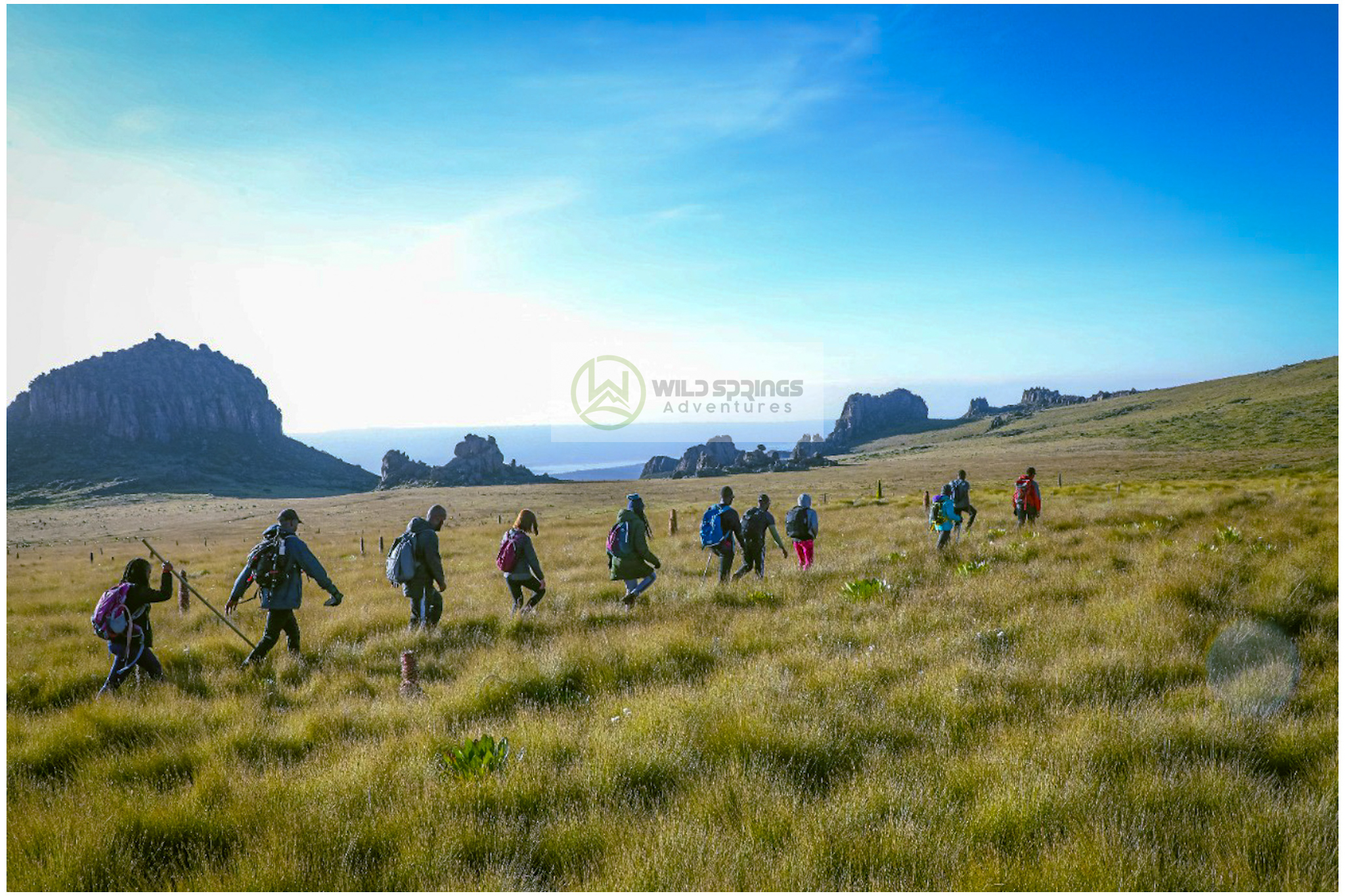
7 Best Aberdare Moorland Trails: Routes & Permits
7 Best Aberdare Moorland Trails: Routes & Permits
The Aberdare Range’s seven best-known moorland trails are Mount Satima (4,001 m), Mount Kinangop (3,906 m), Rurimeria Hill (3,860 m), Seven Ponds (3,840 m), Table Mountain (3,791 m), Elephant Hill (3,658 m) and Mount Kipipiri (3,349 m). All seven sit inside Aberdare National Park, above the park’s bamboo and rainforest belt, in the open Afro-alpine moorland zone that begins around 3,300 m. Elephant Hill is the shortest and most popular; Mount Satima and Mount Kinangop are the toughest and highest, and both are commonly used as altitude-training hikes before a Mount Kenya or Kilimanjaro climb. This guide covers distance, difficulty, access gate, permits, fees and the best months to hike each of the seven, plus the practical mistakes first-time visitors make.
Quick Facts: Aberdare Moorland Hiking
| Fact | Detail |
|---|---|
| Location | Aberdare Range, west-central Kenya, ~160 km north of Nairobi, spanning Nyandarua, Nyeri, Murang’a, Kiambu and Laikipia counties |
| Protected area | Aberdare National Park, gazetted 1950, managed by Kenya Wildlife Service (KWS) |
| Range length | ~160 km (99 miles), average elevation ~3,500 m |
| Highest point | Mount Satima (also called Lesatima), 4,001 m — Kenya’s third-highest peak |
| Moorland zone | Begins around 3,300 m — open Afro-alpine grassland, giant groundsel and giant lobelia above the bamboo/rainforest belt |
| Best hiking months | January–February and July–October (drier, clearer skies); October–December is greener but mistier and slipperier — reconfirm locally, moorland weather changes fast |
| Access gates | Shamata, Mutubio, Wandare and Njabini, depending on trail |
| Typical guide requirement | KWS-registered guide/ranger escort required on all named summit trails |
| Payment method at gates | Digital only via KWS eCitizen (KWSPay) — cash is not accepted at park gates |
Table of Contents
- Understanding the Aberdare Range and Its Moorland
- Before You Go: Permits, Fees, Gates and Season
- The 7 Best Aberdare Moorland Trails
- Common Mistakes to Avoid
- What to Pack
- Frequently Asked Questions
- Related Tours, Guides and Destinations
Key Takeaways
- All seven trails are inside Aberdare National Park — a KWS entry fee and (for most routes) a registered guide are required regardless of which trail you choose.
- Elephant Hill is the shortest and most beginner-friendly; Mount Satima and Mount Kinangop are the longest and most physically demanding.
- Most Aberdare moorland hikes double as low-risk, high-value acclimatisation for Mount Kenya or Kilimanjaro, since several trailheads sit above 3,600 m.
- Dry-season windows (Jan–Feb and Jul–Oct) give the clearest views and the safest footing; the moorland turns boggy and visibility drops in the long rains.
- Fees, gate hours and permit rules are set by KWS and can change — always confirm current rates before you travel (see the KWS link in the Permits section below).
Understanding the Aberdare Range and Its Moorland
Topology
The Aberdare Range runs roughly 160 km along the eastern wall of the Great Rift Valley, north of Nairobi, straddling Nyandarua, Nyeri, Murang’a, Kiambu and Laikipia counties. The range averages around 3,500 m in elevation, rising to 4,001 m at Mount Satima — Kenya’s third-highest peak after Mount Kenya and Mount Elgon. Much of the range has been protected as Aberdare National Park since 1950, and it sits within the wider Aberdare Conservation Area, which also includes forest reserves managed jointly with the Kenya Forest Service. Four major rivers rise in the Aberdare moorlands and forests: the Tana (Kenya’s longest river), the Athi, the Ewaso Ny’iro, and the Malewa, which feeds Lake Naivasha in the Rift Valley floor below.
Ecology
Climbing any of the seven trails takes you through three distinct zones: montane rainforest, dense bamboo, and — above roughly 3,300 m — open Afro-alpine moorland. The moorland is defined by tussock grass, giant groundsel (Dendrosenecio) and giant lobelia, plants adapted to freezing nights and intense equatorial sun at altitude. The forested lower slopes hold elephant, buffalo, leopard, giant forest hog and black-and-white colobus monkey, and the range is one of the last strongholds of the black rhino and the IUCN Red List-classified Critically Endangered mountain bongo (Tragelaphus eurycerus isaaci), a forest antelope found almost nowhere else on Earth outside a handful of central Kenyan highland forests. Wild Springs guides carry this conservation context into every Aberdare trip: sightings are never guaranteed, but the ecosystem itself is a reason to hike here, not just the summits.
Before You Go: Permits, Fees, Gates and Season
Every trail on this list sits inside Aberdare National Park, so the same baseline rules apply before you consider which peak to climb.
- Entry fee: KWS charges a standard national park conservation fee (citizen, resident and non-resident tiers apply) plus separate activity fees for guided hiking and, on some routes, fishing or camping. Fees are reviewed periodically by KWS — confirm the current published rate on the official KWS Aberdare National Park page before you travel, since on-the-day figures can differ from older blog posts and third-party fee lists.
- Payment: KWS moved to digital-only payment (eCitizen/KWSPay) at its gates; carrying cash “just in case” will not help if a gate no longer accepts it.
- Guides and rangers: A KWS-registered guide is required on the summit trails (Satima, Kinangop, Table Mountain), both for navigation in fast-moving moorland fog and because the park is home to large, potentially dangerous wildlife. Wild Springs builds a licensed guide into every trail package listed below.
- Gates: Depending on which trail you pick, you will start from Shamata Gate, Mutubio Gate, Wandare Gate or the Njabini access road on the park’s southern boundary. Confirm your gate with your operator — arriving at the wrong gate on a moorland trip can cost you the whole day.
- Season: January–February and July–October are the most reliable windows, with clearer skies and firmer ground. October–December brings green scenery but more mist, mud and slippery moorland tussocks; the long rains (March–May) are the hardest months for visibility and footing on any of the seven trails. Weather at this altitude can still turn quickly in any month — pack for four seasons in one day.
The 7 Best Aberdare Moorland Trails
The table below compares all seven before the detailed write-up of each.
| Trail | Summit elevation | Difficulty | Best for |
|---|---|---|---|
| Mount Satima (Lesatima) | 4,001 m | Strenuous | Highest point in the range; Mount Kenya/Kilimanjaro prep |
| Mount Kinangop | 3,906 m | Strenuous | Kenya’s 4th-highest peak; endurance hikers |
| Rurimeria Hill | 3,860 m | Moderate–strenuous | Scenic moorland with fewer crowds |
| Seven Ponds | 3,840 m | Moderate | Varied terrain between Table Mountain and Rurimeria |
| Table Mountain | 3,791 m | Moderate | Flat summit plateau, wide views |
| Elephant Hill | 3,658 m | Moderate | Beginners; the range’s most popular day hike |
| Mount Kipipiri | 3,349 m | Moderate | Dormant volcano; shortest, lowest of the seven |
1. Mount Satima (Lesatima) — 4,001 m
Mount Satima, also known as Lesatima, is the highest point in the Aberdare Range and Kenya’s third-highest mountain. It sits at the range’s northern end, ringed by a cluster of jagged volcanic pinnacles known as the Dragon’s Teeth. Three gates give access — Shamata, Mutubio and Wandare — and the route you choose changes both the difficulty and the length of your day. Because the trailheads already start above 3,000 m and the summit clears 3,900 m, Satima is one of the most effective single-day altitude hikes in Kenya for climbers preparing for Point Lenana on Mount Kenya or a Kilimanjaro summit push.
Wild Springs runs Satima as a guided beginner route from Shamata Gate (Mount Satima Shamata Beginner Hike, from KES 4,500 pp / USD 85 pp), a tougher technical option via the Wandare route (Mount Satima Wandare Route Summit Challenge, from KES 4,500 pp / USD 90 pp), and a dedicated Mount Kenya-preparation ascent (Mount Satima — Mount Kenya Preparation Hike, from KES 4,999 pp). For the full route breakdown, see our dedicated write-up: Mount Satima & the Dragon’s Teeth Hike.
2. Mount Kinangop — 3,906 m
Kinangop is Kenya’s fourth-highest peak and the second-highest point in the Aberdare Range, rising from the range’s southern flank near Njabini and the Engineer area. It is a genuinely strenuous route — long distance, sustained elevation gain, and exposed moorland with limited shelter — and it rewards hikers who already have some multi-hour trekking behind them. Kinangop pairs well with a Satima or Rurimeria climb on a multi-day Aberdare itinerary.
Book it directly via Mount Kinangop — The Second Summit, Southern Aberdare Range (from KES 4,999 pp / USD 99 pp international).
3. Rurimeria Hill — 3,860 m
Rurimeria Hill sits in the northern moorland corridor near Satima, and is often used — as its Wild Springs tour name suggests — as a training ground hike: a serious enough climb to build fitness and altitude tolerance without the full commitment of Satima or Kinangop. Expect open moorland views with noticeably fewer other hikers than the more famous peaks nearby.
Book via Rurimeria Hill Moorland Trek (from KES 4,999 pp / USD 99 pp), or combine it with Satima on the multi-day Aberdares Northern Moorland Traverse (2–3 days, from KES 55,000 pp / USD 650 pp for 6+ person groups). Full trail notes: Rurimeria Hill, Aberdare Range, Kenya and our broader Rurimeria Peak Hiking Guide: Kenya’s Training Ground.
4. Seven Ponds — 3,840 m
Seven Ponds is a roughly 14 km moorland route that runs between the Table Mountain and Rurimeria trailheads, named for the string of small tarns it passes. It offers more varied terrain than a straight summit-and-back hike — rolling moorland, small water features, and long sightlines across the range — and works well as a full-day option for hikers who want distance and terrain variety over pure vertical gain.
Book via Seven Ponds Hike, Aberdare Ranges (from KES 3,250 pp). Full write-up: Seven Ponds Aberdares Hike & Trek.
5. Table Mountain — 3,791 m
Table Mountain earns its name from a distinctive flat-topped summit plateau in the northern Aberdare Range — a roughly 8.5 km route from the trailhead that hides its best views until the final approach, when the moorland opens onto a wide, level top with panoramic sightlines over the range and, on a clear day, toward Mount Kenya itself. It is a moderate route: long enough to be a proper day out, without the sustained technical demand of Satima or Kinangop.
Book via Table Mountain, Northern Aberdare Range (from KES 4,999 pp / USD 99 pp).
6. Elephant Hill — 3,658 m
Elephant Hill is, by Wild Springs’ own booking volume, the most popular trail in the Aberdare Range — and for good reason. Starting from the Njabini route on the park’s southern side, it climbs roughly 700–1,000 m of gain to a 3,658 m summit in a well-marked, moderate day hike that suits first-time moorland hikers and families with hiking experience, while still delivering the full Afro-alpine landscape and wide views the range is known for.
Book via Elephant Hill — Njabini Route, Aberdare National Park (from KES 3,500 pp for groups of 5–6; solo from KES 4,999 pp). Full trail guide: Elephant Hill Hike: The Most Popular Trail in the Aberdare Range.
7. Mount Kipipiri — 3,349 m
Mount Kipipiri is the outlier on this list: a dormant volcano standing apart from the main Aberdare ridge, about 32 km northeast of Lake Naivasha in the Wanjohi Valley. At 3,349 m it is the lowest and generally most accessible of the seven, making it a good choice for hikers building up to the higher moorland peaks, or for those combining a hike with a Rift Valley lake visit on the same trip.
Book via Mount Kipipiri — The Butterfly Mountain, Wanjohi Valley (KES 4,999 pp citizens / KES 5,700 pp EA residents / USD 99 pp international). Full write-up: Hiking Mount Kipipiri.
Beyond the seven: other named moorland routes
Two further options are worth knowing if the classic seven don’t fit your dates: Rhino Hill (from KES 4,999 pp), another northern moorland trail near Satima and Rurimeria, and the 12 Apostles Hike, widely considered the range’s toughest single-day trail. Hikers with more time can also link several peaks on the Aberdares North to South Traverse (72 km, 5 days/4 nights, from KES 65,000 pp) or the shorter Aberdares Southern Traverse — Mutubio Gate to Njabini Gate (from KES 55,000 pp).
Common Mistakes to Avoid
- Underestimating moorland weather. Afro-alpine moorland above 3,300 m can swing from bright sun to freezing fog and rain within an hour, on any trail and in any month. Pack layers and waterproofs even on a “dry season” booking.
- Arriving at the wrong gate. Satima alone has three access gates (Shamata, Mutubio, Wandare) with different routes and drive times. Confirm the exact gate with your guide the day before, not the morning of.
- Skipping a guide to save money. KWS requires a registered guide on the summit trails for good reason — moorland fog reduces visibility fast, and the terrain has no clear trail markers in poor conditions.
- Treating Elephant Hill as “no training needed.” It’s the easiest of the seven, not an easy hike in absolute terms — a 700m+ gain at over 3,000 m altitude still demands a reasonable fitness base.
- Assuming cash works at the gate. KWS park fees are digital-only (eCitizen/KWSPay); arrange payment with your tour operator in advance rather than expecting to pay cash on arrival.
- Ignoring altitude on “just a day hike.” Several of these trailheads and summits sit at Mount Kenya-base-camp altitude or higher. Hydrate well the day before, eat properly, and tell your guide immediately if you feel headache, nausea or unusual fatigue.
What to Pack
Aberdare moorland conditions demand real mountain layers, not just a light jacket. At minimum: sturdy waterproof hiking boots, a warm insulated mid-layer, a waterproof/windproof outer shell, gloves and a warm hat, sun protection (UV is intense at altitude even in cold weather), 2–3 litres of water capacity, and trekking poles for the tussock-grass sections. If you need to buy or rent gear before your hike, Wild Springs’ Nairobi outdoor shop stocks hiking boots, jackets, base layers and backpacks suited to Aberdare and Mount Kenya conditions: visit the Wild Springs gear shop. For a fuller packing breakdown that also applies to Aberdare moorland days, see our Essential Gear Checklist for Mount Kenya Trekking and our general Kenya Safari Packing List.
Frequently Asked Questions
Which is the easiest Aberdare moorland trail for beginners?
Elephant Hill (3,658 m) is generally regarded as the easiest and most beginner-friendly of the seven, with a well-established route from the Njabini gate and a moderate elevation gain. It is also, by booking volume, the most popular trail in the range.
Which Aberdare trail is best for Mount Kenya or Kilimanjaro training?
Mount Satima (4,001 m) and Mount Kinangop (3,906 m) are the two most commonly used for altitude preparation, since both push well above 3,900 m in a single day and expose hikers to real moorland weather and terrain similar to the lower slopes of Mount Kenya.
Do I need a permit to hike in Aberdare National Park?
Yes. All seven trails sit inside Aberdare National Park, so a standard KWS park entry fee applies, plus activity fees for guided hiking. Confirm current rates on the official KWS Aberdare National Park page before booking, since fees are reviewed periodically.
Is a guide required for these trails?
Yes, on the summit trails a KWS-registered guide is required, both for park rules and for genuine safety — moorland fog can drop visibility with little warning. Every Wild Springs Aberdare trail package includes a licensed guide.
When is the best time of year to hike the Aberdare moorlands?
January–February and July–October are the most reliable windows, with clearer skies and firmer, drier moorland underfoot. October–December is greener but mistier and more slippery; the March–May long rains are the most difficult months for visibility and footing.
Can I see wildlife on these hikes?
Sightings are never guaranteed, but the Aberdare forest and moorland zones support elephant, buffalo, leopard, black-and-white colobus, and — rarely — black rhino and the critically endangered mountain bongo. Wildlife is more commonly seen on the lower forest sections than on the open moorland summits.
Related Tours, Guides and Destinations
If you’d rather see the whole Aberdare Range on safari before or after your hike, our Aberdare Safari — Waterfalls, Wildlife and Lodge Under the Forest and combination packages such as the Aberdare & Mount Kenya Combo and Aberdare & Lake Nakuru Safari Combo pair trail time with game drives. For nearby hiking country, see our Hiking Trails Nyeri: Ultimate Guide to Mount Kenya Adventures, and for general trail safety, our Eco-Friendly Hiking and Safety Tips for Hikers. Browse the full range of guided day hikes and multi-day treks on our Hiking Trips category page, or see more trail write-ups on the blog’s Hikes category.
Conclusion
The Aberdare Range packs seven distinct, bookable moorland trails into a single protected area a few hours from Nairobi — from the beginner-friendly Elephant Hill to the demanding Satima and Kinangop summits. Whichever you choose, the fundamentals stay the same: confirm your gate and fees in advance, budget for genuine mountain weather, and hike with a registered guide. Wild Springs Adventures runs licensed, guided trips on all seven trails and can help you sequence multiple peaks into one trip or build an Aberdare hike into a wider Mount Kenya or Kilimanjaro preparation plan.
Ready to pick your trail? Browse all Aberdare and Kenya hiking trips, or contact our Nairobi team to build a custom multi-peak itinerary.
TRA licence TRA1/47/C01/25895 · TOSK member No. 0082 · TripAdvisor Travelers’ Choice Award winner in 2024, 2025 and 2026. Our guides have led hundreds of riders, hikers and safari-goers across Kenya’s highlands.